


Contractor Friendly
- Layout mode includes tools to locate points, lines, arcs, and DXF drawing entities. Use for cut/fill analysis or prepare reports.
- As-built mode with topo tools lets you measure and store points for export to CAD or import to MicroSurvey Point Prep.
- Watch overview movie
 Easy Plan Entry
- Built-in plan entry tool allows you to enter information from paper drawings directly in the field while Layout automatically computes coordinate points.
- Create lines and arcs along with points, work in different units, or create a template.
- Watch overview movie
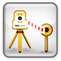 Easy Setup
- Reference point routine allows you to measure to two or more known points to establish your total station location. Allows periodic position checks.
- Remote Benchmark allows you to shoot a known point so its elevation can be transferred to your current total station position.
- Watch overview movie
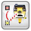
 Easy Layout
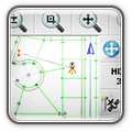
- Graphically stake points, lines and DXF CAD drawings by selecting from the map screen.
- Stake point routine can automatically find the point nearest your current prism or GPS position.
- Includes built-in error checking and cut sheet generator with point deviations and cut/fill values.
- Watch overview movie
 Offsets and Point Patterns
- Lines and arcs can be offset to the left and/or right by a specific distance.
- Compute points down and out from a line or arc, or point offsets between points.
- Includes line partitioning and a point pattern tool for laying out anchor bolt patterns.
- Watch overview movie
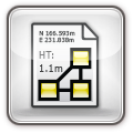 As-Built & Topographic Tools
- Routines are built in to measure existing conditions for as-built reports or drawings.
- Easily record points with elevation that can be exported to other third party applications.
- Record data for cut / fill analysis, volume calculations or DTM model creation.
- Watch overview movie
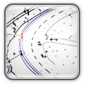 Road Alignment Layout
- Input alignment data from paper drawings into the built-in alignment editor.
- Horizontal alignment, vertical profiles, and templates.
- Easy-to-use stakeout tools.
- Watch overview movie
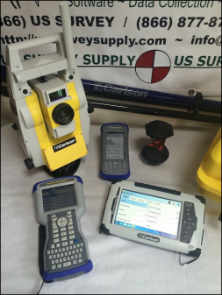
Equipment Support
- Conventional non-robotic instruments supported as well as robotic instruments.
- GPS base and rover systems, network-corrected GPS rover systems, and Leica 3D DISTO.
- Watch overview movie
 Advanced Display and Platforms
- Easy-to-use menu structure makes finding things a breeze, with a unified look and feel across all platforms.
- Total station and GPS toolbars accessible directly on the map screen.
- Live graphics screen allows you to pick data from the map screen for layout.
- Both portrait and landscape devices supported.
 Desktop Companion
- Open Autodesk DWG and DXF files with Point Prep and create points quickly from the digital CAD drawing.
- Export and upload points directly to MicroSurvey Layout for layout at the job site.
- Export and upload a CAD background file (DXF) for use with MicroSurvey Layout.
- Watch overview movie


